How to Build a Useful Drone Map: Key Files and What They Do
What files do you really need to create a drone map that works?
To produce a drone map that is accurate enough for measurement, analysis, or planning, you need more than just a set of images. A useful map is built from specific file types that each serve a distinct role. The essential outputs are an orthomosaic, a digital surface model (DSM), a point cloud, and a georeferenced image set. These four file types form the backbone of any reliable drone mapping project.
Understanding what each file does and why it matters helps you plan your data collection and processing. It also ensures you can deliver results that clients or stakeholders can actually use in their own software and workflows.
The orthomosaic: the visual base layer
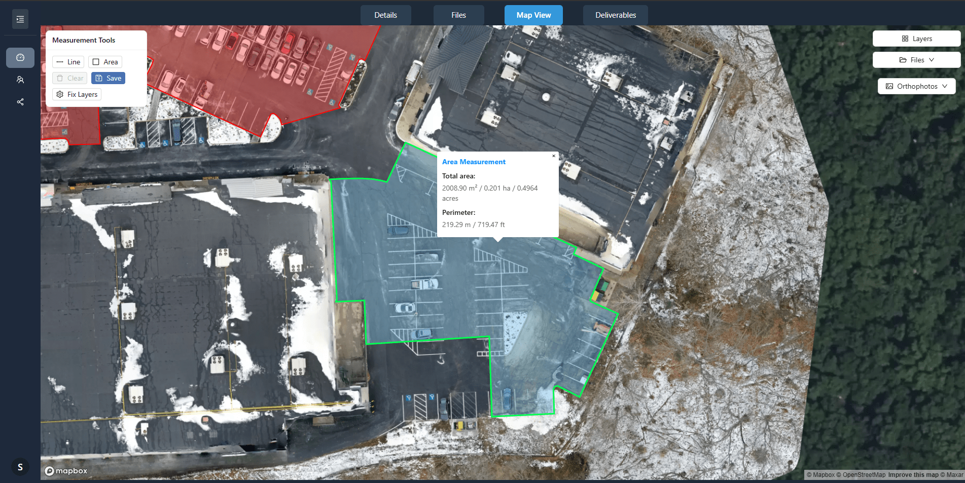
An orthomosaic is a composite image made from many overlapping drone photos. The software stitches them together and corrects for perspective, lens distortion, and terrain relief. The result is a single, seamless, top-down image where every pixel is placed at its true geographic location. This is the file most people think of when they want a map.
Orthomosaics are typically saved as GeoTIFF files. A GeoTIFF contains both the image data and embedded georeferencing information. That means when you open it in GIS software, the map aligns with real-world coordinates automatically. The file can be very large, sometimes several gigabytes, depending on the area covered and the ground sampling distance. For most uses, an orthomosaic resolution of one to three centimetres per pixel is common for close-range drone surveys.
Without an orthomosaic, you have only raw imagery that lacks spatial context. With it, you can measure distances, areas, and volumes directly on the image. It also works as a background layer for site plans, inspection reports, or construction progress tracking.
The digital surface model: elevation data that reveals shape
A digital surface model (DSM) records the height of every surface visible from above. That includes the ground, buildings, trees, and any other objects. Unlike a terrain model that strips away vegetation and structures, a DSM keeps everything. This makes it useful for tasks like measuring stockpile volumes, assessing canopy height, or planning drainage.
DSMs are also stored as GeoTIFF files, but each pixel holds a single value: elevation in metres above a reference datum. The file looks like a greyscale image when viewed, where lighter areas are higher and darker areas are lower. In reality it is a continuous surface of height measurements. The vertical accuracy depends on the quality of the drone's GPS and the ground control points used during processing. For many projects, a vertical accuracy of a few centimetres is achievable with proper setup.
Pairing the DSM with the orthomosaic gives you a 2.5D view. You can see the colour image draped over the elevation model, which helps identify features that might be invisible in a flat photo. It also allows reliable volume calculations, because the software knows the height of the surface at every point.
The point cloud: raw 3D data for advanced analysis
A point cloud is a set of millions of individual 3D points. Each point has X, Y, and Z coordinates and often includes colour information. The point cloud is generated during photogrammetry processing when the software matches features across overlapping images. It represents the most detailed 3D output from a drone survey.
Point clouds are usually saved in LAS or LAZ format (compressed LAS). These are standard formats for lidar data, but drone photogrammetry also produces them. Unlike a DSM, which is a grid of regularly spaced points, a point cloud preserves the irregular spacing of actual measured points. This gives you finer detail in complex areas like building edges or vegetation boundaries. You can filter, classify, and export subsets of the point cloud for specific uses.
For instance, you might extract only ground points to generate a bare-earth terrain model, or keep only the top-of-canopy points to analyse forest structure. The point cloud is the most flexible output, but it requires more specialised software to view and manipulate. Many users will not need it, but for advanced analysis it is indispensable.
Georeferenced imagery and raw files: the building blocks
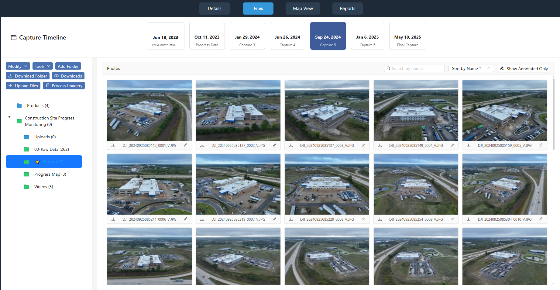
Raw imagery refers to the original photos taken by the drone before any processing. Each photo contains metadata such as GPS coordinates, altitude, camera settings, and timestamps. These raw files are the starting point for all map production. Without them, you cannot create any of the derived outputs. They are usually stored as JPEG or DNG files, and they are the most voluminous part of any project.
Georeferencing is the process of assigning real-world coordinates to each pixel in an image or to each point in a point cloud. For drone maps, this happens automatically during photogrammetry if the drone's GPS is accurate enough. For higher precision, survey-grade ground control points are placed in the field and marked in the images. The georeferencing information is embedded in the output files, so users do not need to do it manually.
Having georeferenced drone outputs means you can overlay your map on existing GIS data, measure distances and areas, and combine multiple surveys over time. This is what turns a collection of aerial photos into a practical mapping tool. Without georeferencing, the images are just pictures with no spatial meaning.
Coordinate systems and ground sampling distance
Every map file must be tied to a coordinate system. Common choices are UTM zones or state plane coordinate systems. The choice affects how distances and areas are calculated. For most drone work, a projected coordinate system is preferable to a geographic one (latitude and longitude), because it preserves accurate measurements.
Ground sampling distance (GSD) is the distance between the centres of two adjacent pixels on the ground. A smaller GSD means finer detail. It is determined by the camera's sensor, the lens, and the flight altitude. For a typical mapping mission, a GSD of one to three centimetres is standard. The GSD value is recorded in the image metadata and affects the resolution of the orthomosaic and DSM. Knowing the GSD helps you decide if the map is suitable for your intended use, such as measuring small features or detecting subtle changes.
Overlap and photogrammetry
Creating a useful map depends on sufficient image overlap. Front overlap (along the flight path) should be at least 75%, and side overlap (between adjacent flight lines) at least 60%. This ensures the photogrammetry software can match features across images and compute accurate 3D positions. Less overlap means more gaps and lower accuracy. More overlap increases processing time and file size but improves reliability.
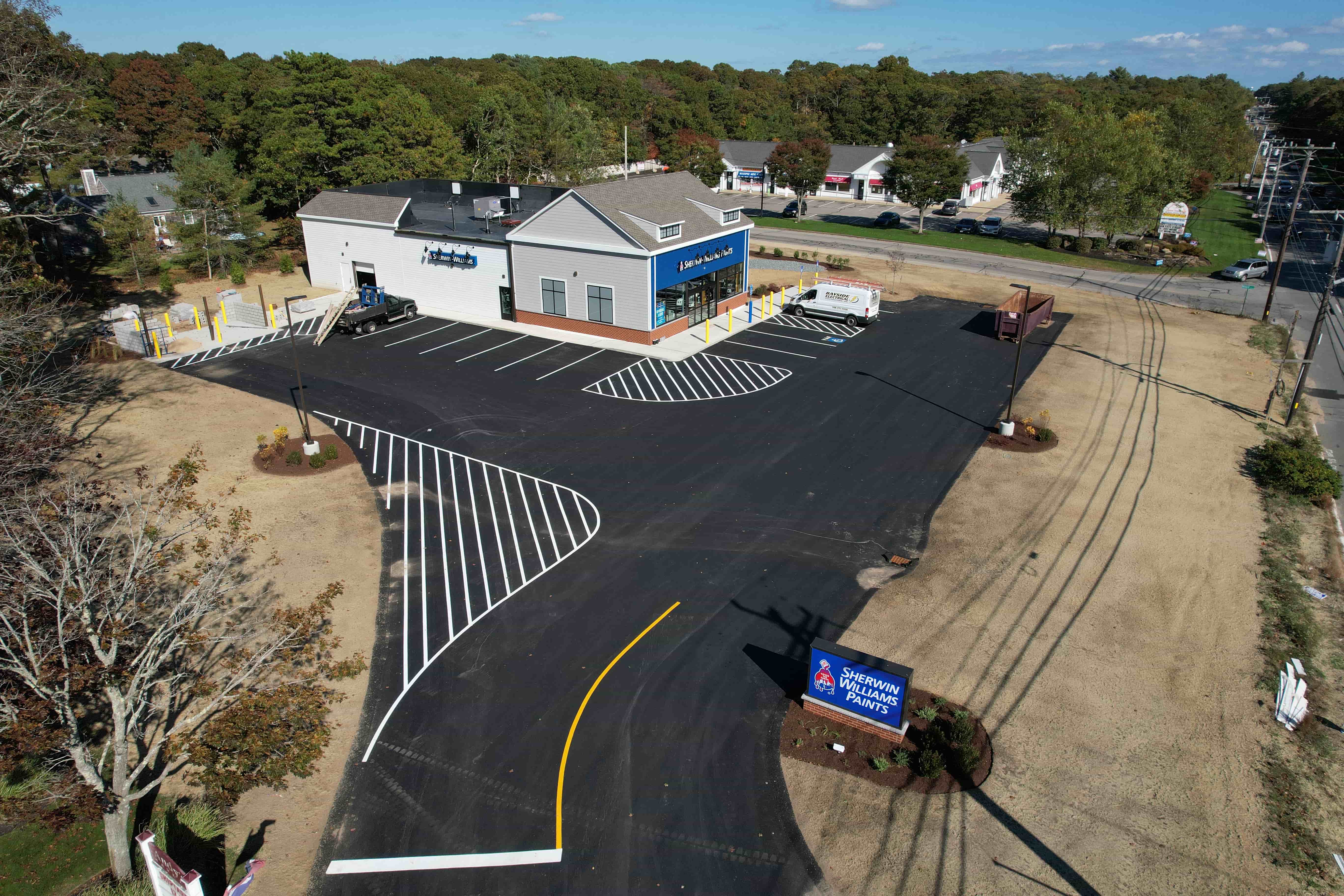
Photogrammetry is the science of extracting measurements from images. In drone mapping, it uses the overlap between photos to triangulate the position of each point in the scene. The software does the heavy lifting, but the quality of the input images directly determines the quality of the output files. Blurry photos, inconsistent lighting, or low overlap all degrade the final map.
Putting it all together
When you plan a drone mapping project, think about the end use first. If you only need a visual reference, an orthomosaic may be enough. If you need volume calculations or elevation profiles, add a DSM. For detailed 3D modelling, include a point cloud. And always keep the raw imagery as a backup, because it is the only file that cannot be recreated from the others.
Delivering a complete set of georeferenced drone outputs gives your clients or colleagues the flexibility to work with the data in whatever software they use. They can measure, analyse, and combine the map with other datasets without having to reprocess anything. That is the difference between a pretty picture and a useful map.